HDR for Drones: How Real Estate Photo Editing Keeps Aerial Images Sharp
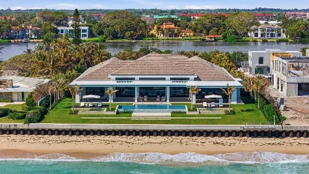
Aerial photos have become a standard part of real estate listings. They show scale, layout, and location in a way ground shots never can. But drone photography comes with a problem most people don’t think about: movement.
Even when a drone is hovering, it’s never perfectly still. Wind, vibration, and tiny position shifts all happen between shots. When photographers capture bracketed exposures from the air, those small movements can turn into blur, ghosting, or soft edges in the final image.
This is where real estate photo editing for drones becomes very different from editing interior photos. In this article, we’ll explain why aerial HDR is challenging, how alignment problems show up, and how we handle drone brackets at AutoHDR so the final 4K image stays crisp and professional.
Why Drones Never Stay Perfectly Still
Modern drones are incredibly stable, but stability isn’t the same as stillness.
Between bracketed shots, a drone may:
- Shift slightly left or right
- Rise or drop a few inches
- Rotate by a fraction of a degree
To the human eye, this movement is invisible. To software merging multiple exposures, it matters a lot.
When these small shifts aren’t corrected, the HDR merge struggles.
What Motion Blur Looks Like In Aerial Hdr
Poorly merged aerial HDR images often show:
- Soft roof edges
- Double outlines on buildings
- Blurry trees or fences
- Loss of fine detail
The image may look fine at first glance, but when zoomed in, or viewed on a large screen, the softness becomes obvious.
This is why standard interior-focused real estate photo editing methods don’t work well for drones.
Why Simple Alignment Isn’t Enough
Some tools try to fix this by aligning images globally. They match one frame to another and hope everything lines up.
The problem is that aerial scenes are complex:
- Foreground and background move differently
- Trees sway between frames
- Parallax shifts occur
A single alignment pass can’t fix all of this. That’s why drone HDR needs more advanced handling.
How Alignment Algorithms Handle Drone Drift
Instead of assuming the scene is static, modern real estate photo editing systems expect movement.
Our approach analyzes:
- Key reference points across frames
- Structural elements like rooftops and roads
- Natural features like tree lines
By comparing how these elements shift between exposures, the system compensates for drone drift before merging begins.
This ensures that when exposures are blended, they line up cleanly instead of fighting each other.
Merging After Alignment, Not Before
One critical detail is timing.
If you merge exposures before correcting movement, blur is locked into the image. If you align first, clarity is preserved.
That’s why aerial HDR processing corrects drift before exposure blending. Each bracket is stabilized against the others so the final merge uses sharp data from every frame.
This step is essential for professional real estate photo editing in aerial work.
Keeping 4k Detail Intact
Drone images are often delivered in high resolution. Buyers zoom in. Agents crop. Listings appear on large screens.
Any softness becomes noticeable.
By compensating for motion early, real estate photo editing preserves:
- Roof texture
- Lot boundaries
- Landscaping details
The result is an image that stays sharp even when viewed up close.
Why This Matters For Property Marketing
Aerial photos are often used as hero images. They set expectations for the rest of the listing.
If the first image looks soft or messy, confidence drops. If it looks clean and sharp, the entire property feels more professional.
That’s why drone operators need real estate photo editing that understands aerial movement, not just exposure.
Consistency Across Multiple Drone Shots
Many properties include several aerial angles. If alignment varies from image to image, the set feels uneven.
Automated alignment ensures that every aerial shot:
- Uses the same correction logic
- Maintains consistent sharpness
- Matches the rest of the listing
This consistency is especially important for photographers delivering high volumes of drone work.
No Extra Work For The Pilot
One advantage of this workflow is that it doesn’t require special flying techniques. Pilots don’t need to hover longer or change how they shoot.
As long as the brackets are captured cleanly, real estate photo editing handles the rest. This keeps shooting fast and efficient while maintaining quality.
Where Humans Still Add Value
Automation handles alignment and merging, but pilots and photographers still play a key role. Choosing angles, timing, and altitude all affect the final result.
The editing system simply ensures that small movements don’t ruin good captures.
Final Thoughts
Drone photography adds huge value to real estate listings, but only if the images are sharp and reliable.
Because drones always move slightly, aerial HDR needs specialized handling. By correcting drift before merging exposures, real estate photo editing can produce clean, detailed aerial images without motion blur.
When alignment is done right, drone HDR stops being risky, and becomes a dependable part of your workflow.
FAQs
Why is HDR processing more challenging for drone photography than interior photography?
Unlike a camera mounted on a tripod indoors, a drone is constantly making small adjustments in position and orientation. These movements can cause bracketed exposures to misalign, making HDR merging more complex and increasing the risk of blur or ghosting.
What causes blurry or soft aerial HDR images?
Softness in aerial HDR photos often occurs when multiple exposures are merged without properly compensating for drone movement. Even slight shifts between frames can create blurred edges, double outlines, and loss of fine detail in buildings, landscaping, and property boundaries.
How does image alignment improve drone HDR results?
Image alignment analyzes how key elements such as rooftops, roads, and landscape features move between exposures. By correcting these shifts before HDR merging begins, real estate photo editing software can produce sharper and more accurate aerial images.
Why is preserving sharpness important in drone real estate photography?
Aerial images are used as featured listing photos and are frequently viewed on large screens or zoomed in by buyers. Preserving detail in roofs, lot lines, landscaping, and surrounding features helps listings appear more professional and trustworthy.
Do drone pilots need to change how they shoot for HDR editing?
In most cases, no. As long as bracketed exposures are captured properly, modern real estate photo editing workflows can handle alignment and HDR merging automatically. This allows photographers to maintain efficient shooting practices while still achieving sharp, high-quality aerial images.